A Fascinating History and Description of the Yea Railway Line by Lance Adams – Part 1 (Tallarook to Cheviot)
From the author…Sometime back I was approached to compile some data on the old railway line for use by rail trail users. I was requested to be informative, historical, but up to date and not to use any railway jargon. Faced with this daunting list of requirements, I sat down with this monumentous task and decided to treat it like I was accompanying rail trail users on their experience as a guide on the rail trail, pointing out where certain points of interest lay. I compiled the entire document from memory, even though I had not been over the track in decades.
BRIEF HISTORY
Train services commenced in November 1883, with a morning service daily from Tallarook to Yea, with a return working around 12.30pm ex Yea. In 1889 the service beyond Yea was commenced towards Molesworth and train operations were shifted to Yea from Tallarook. The service was again extended in 1891, when through services began to Mansfield. By this time Yea was being serviced by a morning and evening train to Melbourne (change trains at Tallarook) and a late morning train to Mansfield returning as an early afternoon train to Yea and Melbourne. (with connections to Alexandra Road, later named Rhodes, Lily & Koriella (At Cathkin). This arrangement continued until 1943, when due to a wartime coal shortage, services were reduced and the morning services to Melbourne, several days a week were removed, along with rail passenger services to Alexandra in 1945. The service to Alexandra remained as available to goods train only until the last train operated to this location in October 1978. Mansfield line services continued with the above service working until railmotor services were introduced over the length of the line in 1949. This provided a morning train ex Mansfield (change at Tallarook for Melbourne) and returning to Mansfield in the early evening ex Melbourne and Tallarook.
This arrangement lasted many years with minor alterations due to the introduction of the larger 280HP Walker railmotors to the line in 1951 and through train workings to Melbourne, until passenger services were removed off the line in 1977. The line operated as a goods train only operations until regular goods train services were with drawn as well in February 1978. Goods trains still operated but on an as required basis, until total closure in November 1978.
The last train, hauled by a Diesel Locomotive Y 158 departed Yea at 6.30pm on Monday 06/11/78. Causing Yea to become devoid of railways from that date. No train ever visited the Yea area again.
HISTORY AND DETAILS – TALLAROOK TO YEA AND CHEVIOT
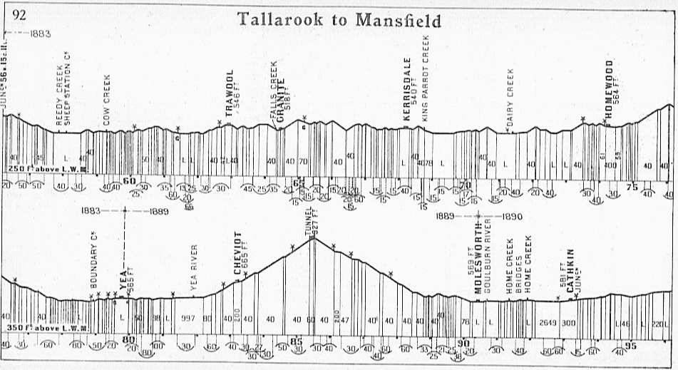
The line branches away from the main North East Railway on a 600 metre curve, at app. 90kms from Melbourne (396 metres above sea level), and while descending a long steep drop on some grades as steep as 1 in 40, traversing School House Lane & several 1000 metre curves, before crossing Reedy Creek near the historic homestead “Landscape” sporting picturesque gardens. This property cannot be appreciated, from the view gained from the main road.
REEDY CREEK TO COW CREEK
This location, “The Reedy Creek bridge crossing”, was the site of a serious derailment in the late 1920’s when the morning train from Melbourne, arrived at the bridge, simultaneously with an inland Tsunami thundering down the creek. The Dd Locomotive made it across the creek crossing, with the passenger cars stranded on the Tallarook side of the bridge, whilst the goods trucks in the middle of the train, were swept clean off the line. Attempts to get the train driver’s attention by local residents were unsuccessful. Their efforts were in vain, & the incident was inevitable. When the line was constructed, a timber trestle bridge would have spanned Reedy Creek, but was replaced in the mid 1940’s, by the concrete & steel bridge, standing here today.
COW CREEK TO FIVE MILE GATEHOUSE
From here, the formation continues on basically level terrain, traversing a consecutive, 800metre and 600 metre curves, before climbing a short 1 in 40 upgrade. The line then drops sharply, down a short 1 in 40 gradient, traverses two 800 metre curves & crosses “Cow Creek”. After a slight up gradient , it crosses an old Road Crossing (long disappeared) on a right hand sweeping 600 metre curve, after commencing as a 500 metre curve before dropping sharply & undulating.
FIVE MILE GATEHOUSE TO TRAWOOL

J514 between Trawool and the 5 mile gatehouse
Rounding these curves, we come to the site of the 5 mile gatehouse at app.101kms from mileage 0 in Melbourne The former main road used to cross the right of way here, the site being extensively modified in the 1920’s with the main road re-aligned to stay on the right hand side of the trail. The former main road was abolished, & consequently the site, gatehouse & gates were removed, with the alterations. This site was one of a number of locations, in the state of Victoria that had hand operated gates, not protected by lineside signals.
These gates were normally closed, against road traffic. When it was required to open the gates for road traffic to be let through, the road user, had to rouse the gate attendant, who after contacting the Signalmen at both Tallarook & Yea, to find out if there was a train in the section. & its approximate whereabouts, would then operate the gates, allowing the road user to go over the line, at his own risk, this arrangement, common in this era, was signified to Drivers of trains, by the attaching of a small white triangular shaped board, to the advance crossing approach board, placed twice the distance out, than normal. This arrangement became unworkable in the late 1920’s with the consequent increase in road traffic, with more cars hitting the Victorian road system. This location featured in a Railway awareness campaign to increase level crossing awareness in 1923 titled, “Stop, Look & listen” An early Red “Austin A7”, featured in the promotion as well.
This unusual safety procedure remained in force in Victoria till into the 70’s, when the last two locations at Paddy & Lonsdale Streets, Mentone, just out of Cheltenham in the Metropolitan area of Melbourne, were converted to a boom barrier, type arrangement. Paddy Street however was blocked off altogether.
TRAWOOL TO GRANITE
The line then continues to undulate, heading slightly uphill, traversing a series of curves, some as tight as 300 metres, before a major heavy climb of 1 in 40 into Trawool Station, (380 metres above sea level) crossing the Main Goulburn Valley Highway on a right hand curve of a 600 metres , which sweeps through the entire station & platform area. Note the tall conifer, pencil pine trees on the platform, planted in the 1930’s. From here the line drops sharply, before a tight pinch, & meanders its way down behind the Trawool Hotel via a series of 800 metre, 500 metre and 600 metre curves & into the Station of Granite, originally named Wrights Siding, & later Trawool Falls (Altitude 370 metres above sea level).
GRANITE TO NINE MILE GATEHOUSE
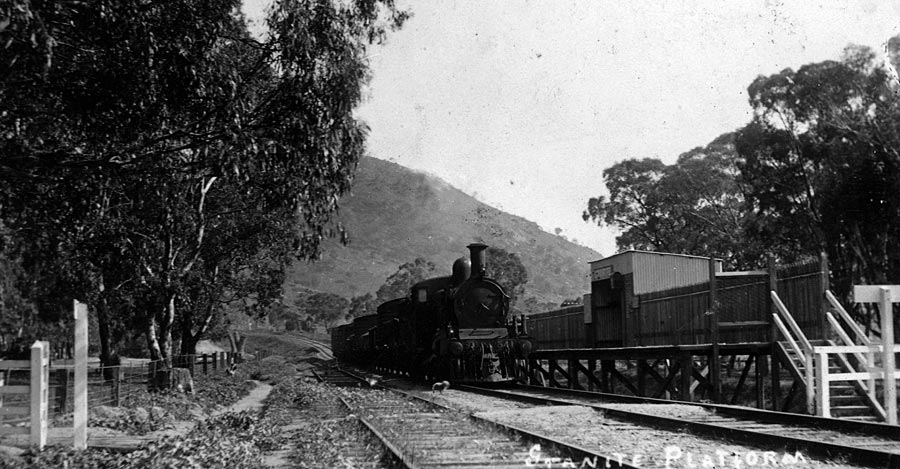
DD 541 at Granite Station
Granite was a small wayside siding & station, opened after the line commenced running, to serve a small granite quarry, specialising in monumental products, with a small human powered push cart tramway, to bring the quarried product from in the quarry, above Trawool Creek,(Formerly Falls Creek) down to the rail siding at Granite. There have been two wooden platforms over the lifespan of Granite station, both now having been long removed. The first one being on the Trawool side of Trawool Creek, situated on the left side of the line, with the replacement platform erected on the opposite side of Trawool Creek, closer to the Trawool Hotel on the right hand side of the line. The station ceased to exist after quarrying became un-economical in the late 1950’s. Several historic photographs adorn the walls of the Trawool Hotel, of the Granite Quarry & its operation, & are well worth a quick look and visit to this establishment. From here the line rises acutely by a 1 in 40 upgrade, through a series of tight curves, some as tight as 300 metres. If ever a train would have stalled, with an inability to take the whole train forward a/c too much weight between Tallarook – Yea, it was here. Many a train has been divided into two pieces here, with half the train going on to Kerrisdale (the next station) and returning for the rear portion, to clear the section and unite the train.
NINE MILE GATEHOUSE TO FLYNN’S CREEK
After topping the grade here, it is only short, sharp down hill run, via 300 metre curves, to the 9 mile Gatehouse, where the Goulburn Valley Highway crosses the railway formation once again. Locally known as “the house on stilts”, it was worked under the same rules as the 5 mile gatehouse, but lasted slightly longer before being abolished on the 27/03/47. This unique building that was here, was situated in the small triangular piece of land, backing on the railway formation, and facing the main road. If you leant out of a train here, you could almost touch the roof of the house. A feat often attempted by passengers from a passing train.
FLYNN’S CREEK TO KERRISDALE
The rail trail now goes under the main road, via an underpass at this site. Once through the underpass, the railway is rejoined on a series of 300 metre curves, on an embankment, and a drop is made towards “Flynns Creek”, with the remains of a local hops farm on your left hand side. A steep downgrade for a short distance is encountered, hugging the sides of the “Warrigul” rocks, traversing many tight curves above the river flats. A short sharp rise is encountered and through a series of 300 metre, 500 metre and 700 metre curves, past the old ballast quarry at approximately 108kms circa 1888 and a 400 metre curve.
KERRISDALE TO KING PARROT CREEK
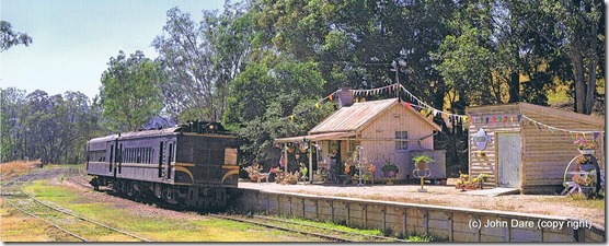
Kerrisdale Station
Kerrisdale is reached through a long 1000 metre right hand Curve. Kerrisdale (altitude 378 metres above sea level) is an interesting place, as when the line was constructed in the 1880’s it was the major construction point for the growing railway, with a major construction camp situated near the King Parrot Creek, just beyond the Kerrisdale Station proper. This camp, at the time, was a larger settlement than Yea, and boasted hotels, schools and a hospital. Nothing now remains of this temporary settlement. Kerrisdale is now home to the “Kerrisdale Mountain Railway”, which houses many operating exhibits from a bygone era, including the original Kerrisdale Station Building and is well worth a visit. Leaving Kerrisdale, the complete railway formation has been regraded & changed from the time the railway operated. An overbridge, built in the 1960’s conveying the Goulburn Valley Highway over the railway, has been removed, the highway re-aligned, and the whole area regraded to suit this new alignment. The rail trail only vaguely reflects the original course of the line.
KING PARROT CREEK TO DAIRY CREEK
Once you are back on the original Railway alignment, the King Parrot Creek Bridge is crossed by a modern concrete and steel construction, replacing the original wooden trestle bridge. The area under the bridge and to the immediate right was the site of the temporary construction camp when the line was built in the 1870’s that was mentioned earlier. From here, the line leaves the King Parrot Creek area by means of three 300 metre curves, then heads downhill into a level area. followed by a sweeping 700 metre and 800 metre curve, which take you into a series of three 300 metre curves. From here, the trail rises up a short 1 in 40 grade. On top of this grade, is the local wildlife refuge, called “The Haven”. A refuge for Native Wild Animals requiring special attention, before being released back into the wild, worth a visit, particularly if you are accompanied by children.
DAIRY CREEK TO HOMEWOOD
The line drops for a short distance on a 1 in 40 grade, rounds a left hand 400 metre curve, a right hand 400 metre curve and enters the flood flats of “Dairy Creek” via a sweeping 800 metre curve. After passing a road crossing, the “Dairy Creek” is crossed with a low level, modern, concrete and steel bridge constructed in the 1940’s.
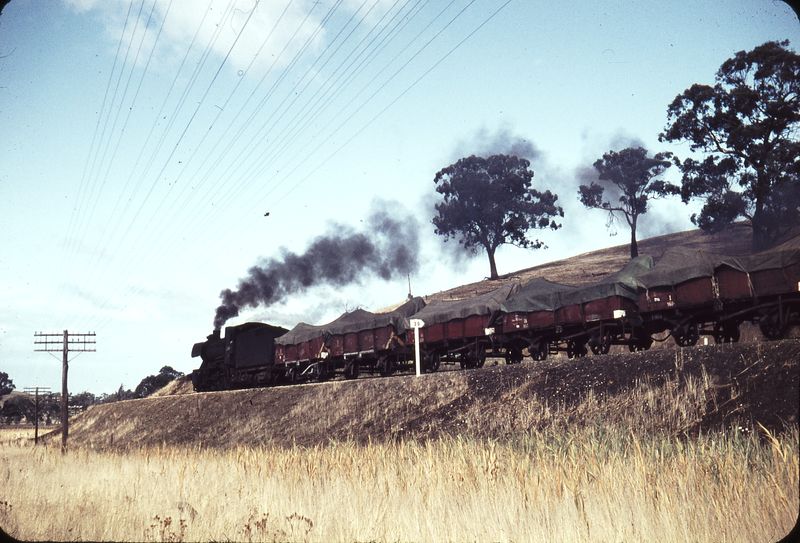
J515 nears Homewood
HOMEWOOD TO BOX HILL
From here, the line basically continues in a downhill direction for a short distance, meeting three curves in its progress, an 800 metre left hand curve, a right hand 400 metre curve and a final 800 metre curve heading up hill, via several short level sections before a 1 in 40 climb takes the trail towards Homewood. Here the railway again meets the Goulburn Valley Highway on the top of the gradient. This area is also unrecognisable from when the railway operated, with the re-alignment of the Goulburn Valley Highway in the 1990’s. This caused the Highway, at this location to now traverse the former Railway line into the Homewood station area (altitude 172 metres above sea level). After rejoining the railway proper, leaving Homewood by a 600 metre curve, the line rises drastically on a long climb, starting out at a gradient of 1 in 50 and steepening to 1 in 40 towards the top of the gradient, after going through two 800 metre curves. This hill is known locally as “Box Hill”, and is the severest climb between Tallarook & Yea. A long, tough climb!
BOX HILL TO YEA
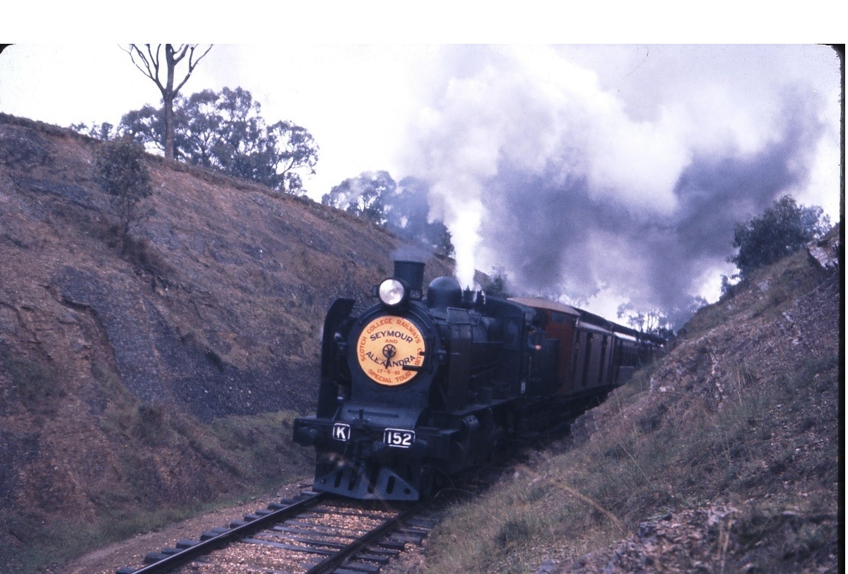
K152 Climbing box Hill between Homewood & Yea
After topping “Box Hill” a steep downgrade, is met with drops of 1 in 40, an 800 metre curve, sharpening to a 600 metre curve, before crossing “Hamilton’s Road” and immediately after crossing “Hamilton’s Road” a 600 metre curve is reached and the trail continues downgrade through another long 1000 metre curve, before reaching the bottom of the grade. The trail now continues, undulating but slightly uphill through a 1000 metre left hand curve before negotiating the Aldous Avenue, Road Crossing.
YEA TO CHEVIOT
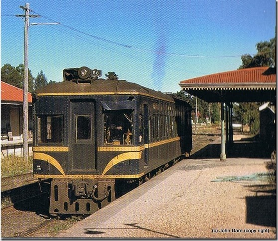
Yea Station
The line rises again here, through a long 1000 metres left hand curve, crosses “Boundary Creek” & North Street in the process and enters the Yea Township via a sweeping left hand curve of 1000 metres Heading slightly uphill, Melbourne Road is crossed after which the line rises sharply on a 400 metre right hand curve, before crossing another road, which up to the closure of the line was protected by hand operated Wooden Gates at Lyon Street The Yea Railway Station is situated on a level area of ground, between the Lyon Street Gates and the Melba Highway.
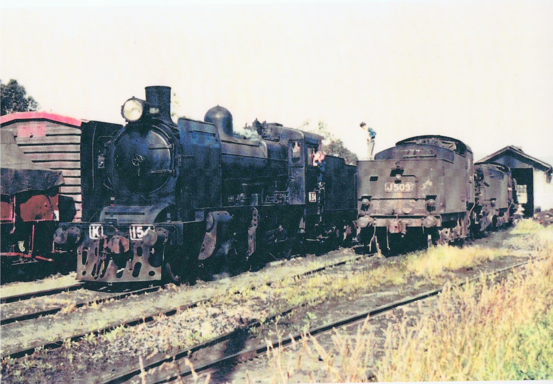
Yea Railway Depot
The area at the Mansfield end of the Railway Station at Yea, including the station area at this end, was drastically altered in 1971 to re-align the Melba Highway, with later regrading work done in the 1990’s when the Yea Hospital helipad was constructed on the site of the Yea locomotive depot, 16 metre turntable & coal stage. Nothing now remains of this previously bustling area.
The original Yea Locomotive shed was moved to Wallan in 1892 and a new running shed built in 1929, which remained on site till the abolition of steam motive power, off the line. The shed was removed, but the attached oil house remains in Yea as a garden shed, at a private house in the Yea township today.
The 80 mile post (129kms app.) , formerly positioned outside the Yea Locomotive Depot underneath a water tower has also has found a new location in the rear of a private residence in the Yea township. The Yea Station area (altitude 385 metres above sea level) is left, through the site of the former “Oliver Street” hand operated, wooden gates, via a 400 metre right hand curve and basically undulates on a 1 in 997 gradient for about two kilometres then going through two 1600 metre and 2000 metre curves until it reaches the Yea River bridge, which was built to replace the original bridge, replaced in 1945. Opened with the line, early ballast siding, used in the construction of the line, branched off here for the collection of river ballast from the Yea River then known as Muddy Creek. No trace of this short ballast line can be found today, just stories lost in time.
The pile remains of the original bridge and can be clearly seen to the immediate left of the trail formation. This bridge was locally known as the “long bridge” as the original water crossing, was one long wooden construction, like the bridges at Yarra Glen and Orbost, rather than the way it is today, separated by several earthen embankment sections, separating several individual bridge spans, The river is crossed via the bridge, on a 600 metre left hand curve.
CHEVIOT

From here, the line rises sharply leading to the climb to the tunnel, some 9 plus kilometres ahead. This climb, on severe grades was a challenge to engine crews operating steam locomotives. Over the decades the line operated using this form of traction. The grades start out as an easy 1 in 80, but get tougher towards the tunnel’s southern portal, steepening to 1 in 40 gradients. Two curves are negotiated between the river crossing and Cheviot. The first is a sweeping long gentle left hand curve of 1200 metres and a second, a little sharper right hand curve of 800 metres. This then takes you across a local road crossing and into the Cheviot Station on a 1 in 200 upgrade.
